
Cedar City ZIP Codes and Their Reach
Utah’s official ZIP list names two Cedar City entries. They are delivery designations, not municipal census tracts, resident rolls, or parcel boundaries. Use the ZIP as a first filter, then confirm the street, direction, city field, and municipality through USPS and Iron County GIS. The same address can also carry a different ZIP in an older newspaper, directory, or tax mailing field.
| ZIP Code | Areas Covered | Post Office | Notes |
|---|---|---|---|
| 84720 | Cedar City delivery addresses using the 84720 designation | Cedar City Post Office route | Check current USPS result |
| 84721 | Cedar City delivery addresses using the 84721 designation | Cedar City Post Office route | Also used by older/newer records |
The research did not locate a separate PO-box-only or unique institutional ZIP for Cedar City. It did locate a major transition: USPS moved about 6,900 deliveries from 84720 to 84721 on July 1, 2008. That shift makes both values important when a ZIP code directory search reaches into older records.
The Utah official ZIP list is the linked source for checking Cedar City’s named postal entries.
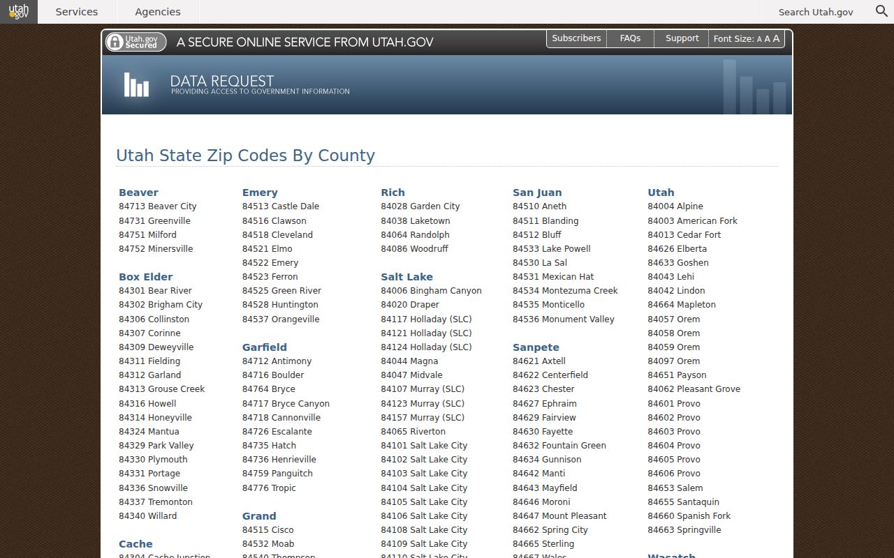
Use the official list to confirm the postal designation, then return to the parcel and address custodians for resident-related questions.
Finding Cedar City Residents by ZIP Code
A ZIP code directory search can narrow an address set, but the available portals describe different things. Iron County GIS and EagleWeb may return property accounts, owners, mailing fields, values, taxes, or legal references. Utah voter data is controlled and excludes protected records. Business and license portals accept ZIP filters for entities or credentials, not household members.
- Verify the street and ZIP combination with USPS, testing both Cedar City ZIP values when the record is old.
- Use EagleWeb Account Search or the parcel layer and save the parcel, account, owner, and mailing fields.
- Compare the row with Utah Vote Search only for the public registration fields the state releases.
- For entities or construction ties, use the Utah business list or DOPL registry ZIP filter.
- Move from the ZIP to the exact street and parcel using the Cedar City street directory route.
ZIP sorting is most useful before an address search. It does not show a complete set of residents, and an owner mailing ZIP may belong to another Utah city.
Why 84721 Matters in Cedar City Records
The July 1, 2008 USPS bulletin moved about 6,900 deliveries from 84720 to 84721. A directory entry, deed mailing field, newspaper notice, or family letter written before that change may use 84720 even when a current postal check returns 84721.
Keep the old ZIP as a date clue. It does not change the street or prove a city-limit decision. Use the USPS address tool to check delivery, then use GIS and the Recorder for land and legal history.
The USPS 2008 bulletin is the linked source for the dated delivery realignment.
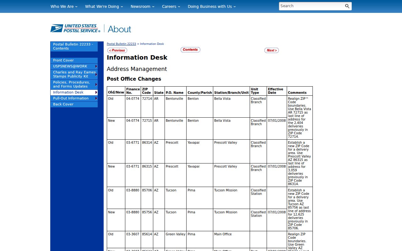
Widen historical searches to both ZIP codes when the record date falls near or before the 2008 change.
Use Cedar City Post Office Routes
USPS provides three useful modes: By Address, By City and State, and Cities by ZIP. The address form makes the street required, with company, apartment, city, state, and ZIP fields available. Use it to fix a delivery spelling before a ZIP code directory search reaches county records.
The Cedar City Post Office details are a delivery resource, not a people index. USPS confirms a postal combination. It does not reveal who receives mail, who owns a parcel, or who lives in a building. Those questions belong to the custodian for the relevant record.
The Cedar City Post Office listing is the linked source for the local delivery point used in ZIP verification.
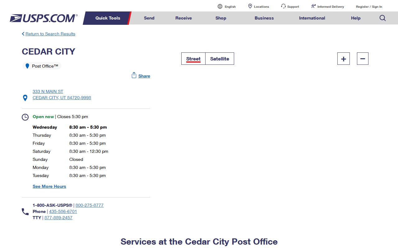
Let USPS settle the delivery combination, then let county or state custodians answer the underlying record question.
Run Cedar City ZIP Fields Through GIS
Iron County’s parcel layer can be queried by municipality and related attributes, and EagleWeb Account Search connects property accounts with owners, values, taxes, legal information, and recorded-document abstracts. A mailing ZIP may be the owner’s out-of-town address. A returned parcel row can also have a blank situs field.
| Field | Use in a ZIP search |
|---|---|
| Municipality | Keep Cedar City separate from Parowan, Enoch, or another town. |
| Parcel and account | Save the property identifiers before narrowing by street. |
| Mailing address and ZIP | Record the tax-notice location, not an assumed situs. |
| Situs address | Use the physical location when the field is populated. |
| Book/page and entry | Carry the legal clue into Recorder research. |
The ZIP-capable property route has a useful warning built into its structure. EagleWeb Account Search may connect a ZIP through the owner’s mailing address, while the GIS parcel row is tied to the land. A ZIP returned from a property account can therefore point outside Cedar City even when the parcel is inside it. Save both the mailing city and the municipality field. If the situs field is blank, do not replace it with the mailing address.
Utah voter-file requests are different again. The state describes controlled files, delivery formats, fees, protected-voter exclusions, and limits on use. A ZIP filter can organize a permitted data request, but it does not authorize a public list of everyone in a delivery area. Public lookup fields are narrower than a full file, and a protected address should not be reconstructed from another source.
Cedar City ZIP Filters for Utah Entities
Utah business and license databases have explicit ZIP filters, but they describe organizations or credentials. The statewide business-list request can sort by entity type, NAICS, ZIP, recent changes, new registrations, and status. DOPL’s construction-business registry includes city, state, and ZipCode fields alongside profession, classification, company, and license filters.
These portals can help identify a business connection near a Cedar City address. They cannot establish a household, and the business-list page’s records can be dynamic. The research review showed data current through August 24, 2026, so confirm a current result before relying on it.
The DOPL construction-business registry is the linked source for the ZIP and business fields described in this section.
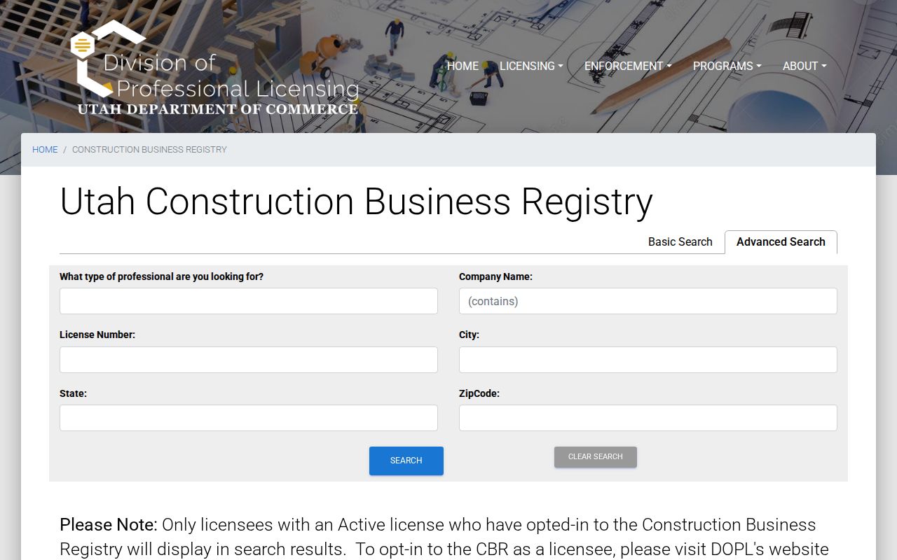
The DOPL construction registry offers Basic and Advanced modes, with profession, classification or scope, company name, license number, city, state, and ZipCode controls. The result is limited to active opt-in construction businesses. Utah’s business-list request also allows entity type, NAICS, recent-change, new-registration, and status filters. Both are useful when a ZIP question concerns an organization. Neither is evidence that a named individual lives in the ZIP.
Read a matching result as an entity or credential clue, not as a resident match for the ZIP.
Cedar’s Main and Center Numbering
ZIP normalization cannot fix a street direction that belongs to another grid. Cedar City uses Center Street or SR-14 as the north-south origin and Main Street or SR-130 as the east-west origin. Enoch uses a Cedar origin, while Parowan, Kanarraville, and other Iron towns use their own. Always keep the municipality with the ZIP.
That matters when a historical family record gives only a street name and a ZIP. Try the direction, town, old ZIP, parcel, and newspaper date together. A ZIP code directory can narrow the delivery area, but the street-level answer belongs in the Cedar City street directory workflow.
Boundary Changes Make ZIP Context Timely
Utah SGID reports two Cedar City municipal-boundary changes in 2024. The older annexation map names areas such as Cottonwood, Cross Hollow, North Interchange, Northfield, Red Hills, South 56, South and West Interchange, Square Mountain, and West Airport or West Extension. Those are planning and boundary clues, not a promise that a ZIP, parcel, and city line match.
For a dated record, save the municipality field and the boundary year. A current city label can hide an older jurisdiction. A current ZIP can hide the 2008 delivery shift. Both changes call for date-aware searching.
When a ZIP result conflicts with a city record, retain both values in the notes and label the source. A property mailing ZIP can belong to the indexed owner, while the parcel sits in Cedar City. A newspaper may use a historical delivery code. A state ZIP table may list a city name without resolving the municipal edge. Those are different claims, and each one needs its own check.
Cedar City ZIP Boundaries Versus Limits
Postal geography and municipal geography answer different questions. A Cedar City mailing address can be assigned through a delivery route that does not match a city boundary. The Utah SGID records two Cedar City municipal-boundary changes in 2024, and the General Plan identifies growth areas around Fiddler’s Canyon, the golf course, Eagle Ridge, the automall interchange, West View, and the west side. Those planning areas are not automatically ZIP or neighborhood boundaries.
Use the official Utah ZIP list for the two named Cedar City entries, USPS for delivery validation, and the parcel map for the land boundary. If the question is who owns or appears on a particular street after the ZIP is known, move to the street directory rather than treating a ZIP code directory as a person list.
Keep the ZIP source beside the date checked. Postal tools, state tables, parcel accounts, and municipal boundaries can be updated on different schedules. A dated note makes a later change easier to explain.
- ZIP versus ZIP+4
- A five-digit delivery area versus the extra four digits used to narrow delivery.
- PO-box ZIP
- A ZIP used for box delivery at a postal facility rather than a street route.
- Unique ZIP
- A designation assigned to one large institution or organization, not a general city area.
- Carrier route
- A postal delivery path inside a broader ZIP area.